2002 Hindu Kush earthquakes
 | |
| UTC time | 2002-03-03 12:08:19 |
|---|---|
| 2002-03-25 14:56:33 | |
| ISC event | 5267309 |
| 2947182 | |
| USGS-ANSS | |
| ComCat | |
| ComCat | |
| Local date | |
| March 3, 2002 | |
| March 25, 2002 | |
| Local time | 16:38 |
| 19:26 | |
| Magnitude | 7.4 Mw |
| 6.1 Mw | |
| Depth | March 3 – 226 km (140 mi) 8 km (5 mi) |
| Epicenter | 36°30′N 70°29′E / 36.5°N 70.48°E |
| Type | Dip-slip |
| Max. intensity | March 3 – MMI VI (Strong)[1]
March 25 – MMI VII (Very strong)[2] |
| Casualties |
|
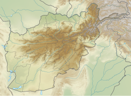
The 2002 Hindu Kush earthquakes struck in northern Afghanistan during the month of March. At least 166 people were killed with a very large and intermediate-depth mainshock on March 3. Three weeks later, at least 1,200 were killed during a moderate but shallow event that had a maximum Mercalli intensity of VII (Very strong). The M7.4 and M6.1 reverse events were focused in the Hindu Kush mountain range area.[1][2]
Tectonic setting
[edit]Northern Afghanistan lies within the broad zone of continuing collision between the Indian plate and the Eurasian plate. The area is seismically active, particularly as a result of faulting at just over 200 km depth within the descending slab. Many large events of M ≥ 7 have been observed in the Hindu Kush, all with similar epicenters, with an approximate periodicity of about 10–15 years. These events have reverse fault focal mechanisms, which for the near-vertical slab indicates active extension. It has been proposed that these earthquakes are a result of "necking" of the downgoing slab, a process that may eventually lead to break-off.[4]
Smaller shallow focus earthquakes are also observed in the region, particularly associated with north–south trending zones of right lateral strike-slip, such as the Chaman Fault, with an increasing degree of shortening to the north, together accommodating the highly oblique convergence between the Indian plate and the Eurasian plate.[5]
Earthquakes
[edit]The earthquake on March 3 had a magnitude of 7.4 Mw , with a hypocentral depth of 225.6 km. The focal mechanism is consistent with reverse faulting within subducting oceanic crust. Comparison with similar earthquakes in 1993 and 2015, which have very similar depths and epicenters, suggests that the major component of the slip in all three events occurred on the same part of the fault.[4]
The earthquake on March 25 had a magnitude of 6.1 Mw , with a hypocentral depth of 8.0 km. It had a reverse fault mechanism that occurred on one of two possible moderately-dipping north–south trending faults.
Damage
[edit]March 3 event
[edit]At 12:08:19 UTC a 7.4 tremor hit an area 65 km (40 mi) S of Feyzabad, Afghanistan. At least 150 people were killed, several injured and 400 houses damaged or destroyed by a landslide that dammed and flooded Surkundara Valley, Samangan Province. At least 13 people were killed at Kabul and Rostaq and 3 people killed in Bajaur, Pakistan. At least 300 houses were destroyed in Badakhshan and Takhar Provinces. A 45 meter wide fissure opened in Xiker Reservoir in Xinjiang, China. This was a deep focus event and was felt in much of Afghanistan and Pakistan. Felt also in Tajikistan, Uzbekistan, Kyrgyzstan, Kazakhstan and India.[1]
March 25 event
[edit]At 14:56:33 UTC, a magnitude 6.1 tremor hit an area 160 km (99 mi) southwest of Feyzabad, Afghanistan. The United Nations estimated approximately 1,200 people dead and 20,000 families affected. This was a shallow focus event and was felt strongly in much of northern Afghanistan. Also felt in the Islamabad-Peshawar area, Pakistan and at Dushanbe, Tajikistan.[2] In Nahrin, many homes collapsed; the maximum Modified Mercalli intensity was assigned VII (Very strong). The high death toll and heavy damage was attributed to poor construction—most homes were constructed of mud brick.[6]
See also
[edit]References
[edit]- ^ a b c "M7.4 – Hindu Kush region, Afghanistan". United States Geological Survey.
- ^ a b c "M6.1 – Hindu Kush region, Afghanistan". United States Geological Survey.
- ^ National Geophysical Data Center / World Data Service (NGDC/WDS) (1972), Significant Earthquake Database (Data Set), National Geophysical Data Center, NOAA, doi:10.7289/V5TD9V7K
- ^ a b Zhan, Z.; Kanamori, H. (2016). "Recurring large deep earthquakes in Hindu Kush driven by a sinking slab". Geophysical Research Letters. 43 (14): 7433–7441. Bibcode:2016GeoRL..43.7433Z. doi:10.1002/2016GL069603. S2CID 31948667.
- ^ Ambraseys, N.N.; Bilham, R. (2003). "Earthquakes in Afghanistan". Seismological Research Letters. 74 (2): 107–123. Bibcode:2003SeiRL..74..107A. doi:10.1785/gssrl.74.2.107. S2CID 130945532.
- ^ Yeats, Robert S.; Madden, Christopher (2003). "Damage from the Nahrin, Afghanistan, Earthquake of 25 March 2002". Seismological Research Letters. 74 (3): 305–311. Bibcode:2003SeiRL..74..305Y. doi:10.1785/gssrl.74.3.305.
Sources
- Yeats, R. S.; Madden, C. (2003), "Damage from the Nahrin, Afghanistan, Earthquake of 25 March 2002", Seismological Research Letters, 74 (3): 305–311, Bibcode:2003SeiRL..74..305Y, doi:10.1785/gssrl.74.3.305
External links
[edit]- The International Seismological Centre has a bibliography and/or authoritative data for this event.
- ReliefWeb's main page for this event.


